

Port of Casilda (CU CAS)
UN/LOCODE
CU CAS
Harbor size
Medium
Channel depth
6.4 m
Nearest city
Casilda
Body of water
Caribbean Sea; North Atlantic Ocean
Cuba
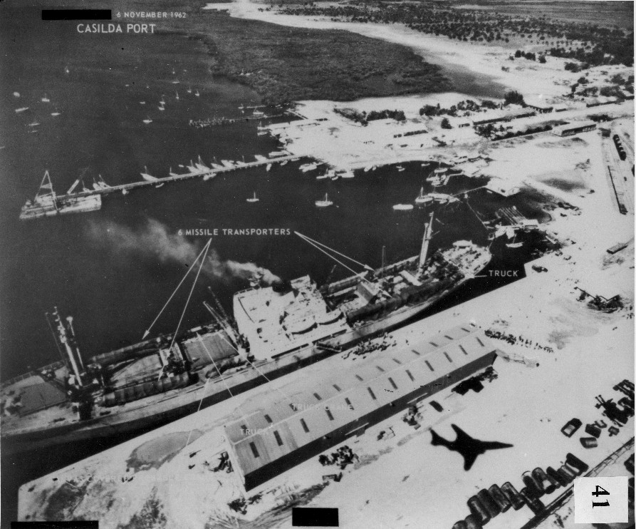 © Unknown authorUnknown author · Public domain
Port information
- Also known as
- Trinidad
- Coordinates
- 21.7500, -79.9833 (21°45′N 79°59′W)On the map
Harbor
- Harbor type
- Coastal, natural
- Shelter
- Fair
- Tidal range
- 0.6 m
- Anchorage depth
- 12 m
- Cargo pier depth
- 6.4 m
- Oil terminal depth
- 6.4 m
- Max. vessel (L × B × draft)
- 170 m × 7.6 m
Services
Pilotage compulsory: Yes
Pilotage available: Yes
Tug assistance: Yes
Quarantine / pratique: Yes
Marine railway (slipway): Small
Rail connection: Yes
Facilities
Wharves
Anchorage
Breakbulk
Oil terminal
Supplies
Fresh water
Located in Cuba, the port of Casilda serves as a call point for merchant shipping. By World Port Index classification, Casilda has a Medium harbor of the Coastal, natural type. Ships approaching Casilda work with a channel depth of 6.4 m.
Frequently asked questions
- Where is the port of Casilda located?
- Casilda is a seaport in Cuba.
- What is the UN/LOCODE of Casilda?
- The UN/LOCODE for Casilda is CU CAS.
- What is the channel depth at Casilda?
- The channel depth at Casilda is 6.4 m.
Nearby ports
- Tunas De Zaza Cuba 47 km
- Cienfuegos Cuba 66 km
- Caibarien Cuba 102 km
- Palo Alto Cuba 107 km
- Jucaro Cuba 118 km
- Isabela De Sagua Cuba 133 km
- Cardenas Cuba 191 km
- Matanzas Cuba 216 km
Distance to major hubs
- Shanghai China 13699 km
- Singapore Singapore 17425 km
- Rotterdam Netherlands 7753 km
- Los Angeles USA 3969 km
- Mina Jabal Ali United Arab Emirates 12905 km
- Hamburg Germany 8076 km
- Santos Brazil 6254 km
- Durban South Africa 13156 km
Evaluate the value of your shipment in an instant
The calculation includes customs clearance, cleaning, excise taxes, VAT, customs tariffs, insurance