

Port of Burgas (BG BOJ)
UN/LOCODE
BG BOJ
Harbor size
Small
Channel depth
15 m
Nearest city
Burgas
Body of water
Black Sea; North Atlantic Ocean
First port of entry
Yes
Bulgaria
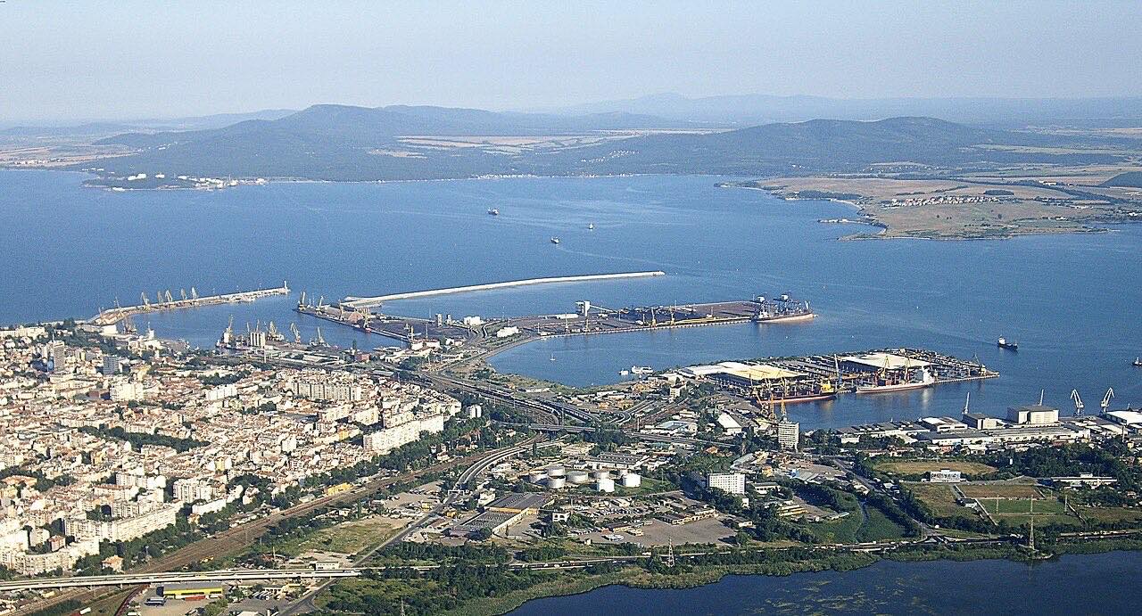 © Burgas_Juni2012_Hafen_und_der_Burgas-See.JPG: Vammpi
derivative work: Vammpi · CC BY-SA 3.0
© Burgas_Juni2012_Hafen_und_der_Burgas-See.JPG: Vammpi
derivative work: Vammpi · CC BY-SA 3.0
Port information
- Also known as
- Burghaz; Druiba
- Coordinates
- 42.4833, 27.4833 (42°29′N 27°29′E)On the map
Harbor
- Harbor type
- Coastal, breakwater
- Shelter
- Fair
- Anchorage depth
- 11 m
- Cargo pier depth
- 6.4 m
- Oil terminal depth
- 6.4 m
- Max. vessel (L × B × draft)
- 252 m × 46 m × 14.8 m
Services
Pilotage compulsory: Yes
Pilotage available: Yes
Tug assistance: Yes
Quarantine / pratique: Yes
Repairs: Limited
Dry dock: Medium
Marine railway (slipway): Large
Medical facilities: Yes
Nearest airport: Yes
Rail connection: Yes
Facilities
Other
Wharves
Anchorage
Breakbulk
Container
Solid bulk
Liquid bulk
Oil terminal
Cranes
Fixed crane
Mobile crane
Floating crane
Supplies
Fuel oil
Fresh water
Diesel fuel
Provisions
Ratings
#152
Container Port Performance Index (2025): #152
44.71
Liner Shipping Connectivity Index: 44.71
Burgas is a seaport on the coast of Bulgaria, handling commercial vessel traffic. The harbor is classed as Small, with a Coastal, breakwater layout. The channel depth runs to 15.0 m, a key limit on vessel draft.
Frequently asked questions
- Where is the port of Burgas located?
- Burgas is a seaport in Bulgaria.
- What is the UN/LOCODE of Burgas?
- The UN/LOCODE for Burgas is BG BOJ.
- What is the channel depth at Burgas?
- The channel depth at Burgas is 15 m.
Nearby ports
Distance to major hubs
- Shanghai China 8029 km
- Singapore Singapore 8799 km
- Rotterdam Netherlands 2017 km
- Los Angeles USA 10851 km
- Mina Jabal Ali United Arab Emirates 3181 km
- Hamburg Germany 1785 km
- Santos Brazil 10559 km
- Durban South Africa 8056 km
Evaluate the value of your shipment in an instant
The calculation includes customs clearance, cleaning, excise taxes, VAT, customs tariffs, insurance