

Port of Botany Bay (AU BTB)
UN/LOCODE
AU BTB
Harbor size
Small
Channel depth
14.4 m
Nearest city
Port Botany
Body of water
Tasman Sea; South Pacific Ocean
First port of entry
Yes
Australia
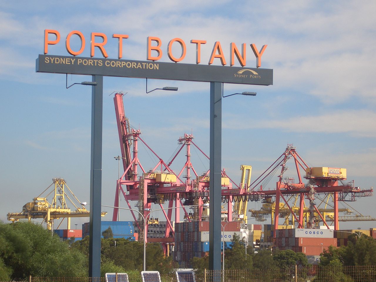 © J Bar · CC BY 2.5
Port information
- Region
- AU-NSW
- Also known as
- Port Botany
- Coordinates
- -34.0000, 151.2333 (34°00′S 151°14′E)On the map
Harbor
- Harbor type
- Coastal, natural
- Shelter
- Good
- Tidal range
- 4 m
- Cargo pier depth
- 13.9 m
- Oil terminal depth
- 12 m
- Max. vessel (L × B × draft)
- 336 m × 48.4 m × 15.2 m
Services
Pilotage compulsory: Yes
Pilotage available: Yes
Tug assistance: Yes
Repairs: Moderate
Medical facilities: Yes
Nearest airport: Yes
Rail connection: Yes
Facilities
RoRo
Wharves
Container
Ice mooring
Liquid bulk
Oil terminal
Supplies
Deck supplies
Fuel oil
Fresh water
Diesel fuel
Engine supplies
Provisions
Located in Australia, the port of Botany Bay serves as a call point for merchant shipping. By World Port Index classification, Botany Bay has a Small harbor of the Coastal, natural type. Ships approaching Botany Bay work with a channel depth of 14.4 m. Port Botany is the nearest city to Botany Bay, linking the port to inland markets.
Frequently asked questions
- Where is the port of Botany Bay located?
- Botany Bay is a seaport in Australia, near Port Botany.
- What is the UN/LOCODE of Botany Bay?
- The UN/LOCODE for Botany Bay is AU BTB.
- What is the channel depth at Botany Bay?
- The channel depth at Botany Bay is 14.4 m.
Nearby ports
- Sydney Australia 15 km
- Port Kembla Australia 61 km
- Jervis Bay Australia 130 km
- Newcastle Australia 131 km
- Batemans Bay Australia 213 km
Distance to major hubs
- Shanghai China 7895 km
- Singapore Singapore 6309 km
- Rotterdam Netherlands 16707 km
- Los Angeles USA 12065 km
- Mina Jabal Ali United Arab Emirates 12069 km
- Hamburg Germany 16298 km
- Santos Brazil 13314 km
- Durban South Africa 10539 km
Evaluate the value of your shipment in an instant
The calculation includes customs clearance, cleaning, excise taxes, VAT, customs tariffs, insurance